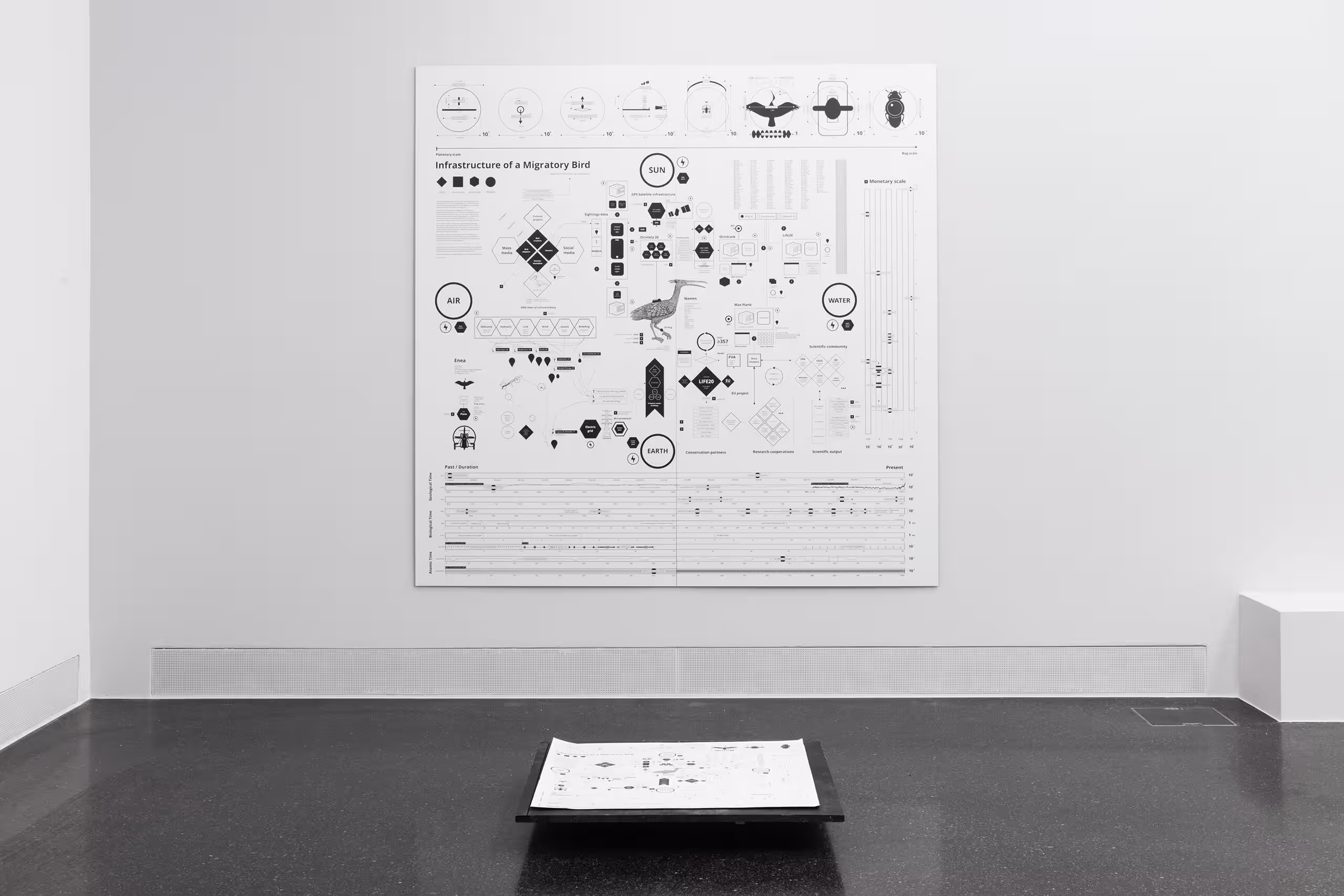
Infrastructure of a Migratory Bird
The “Infrastructure of a Migratory Bird” is a map of the anthropogenic ecosystem assembled for the Northern Bald Ibis, with the goal of enabling wilderness in the Anthropocene.
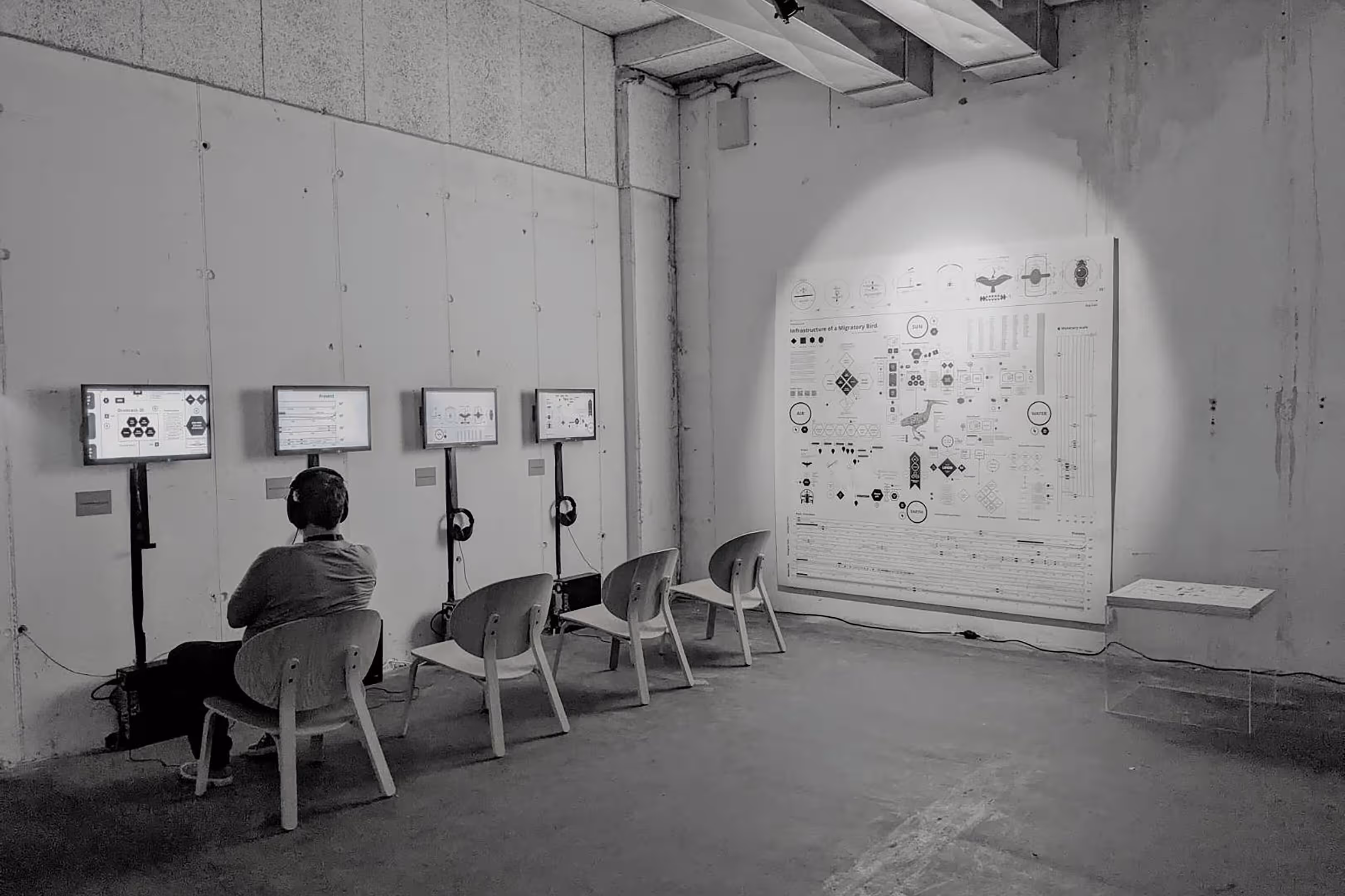
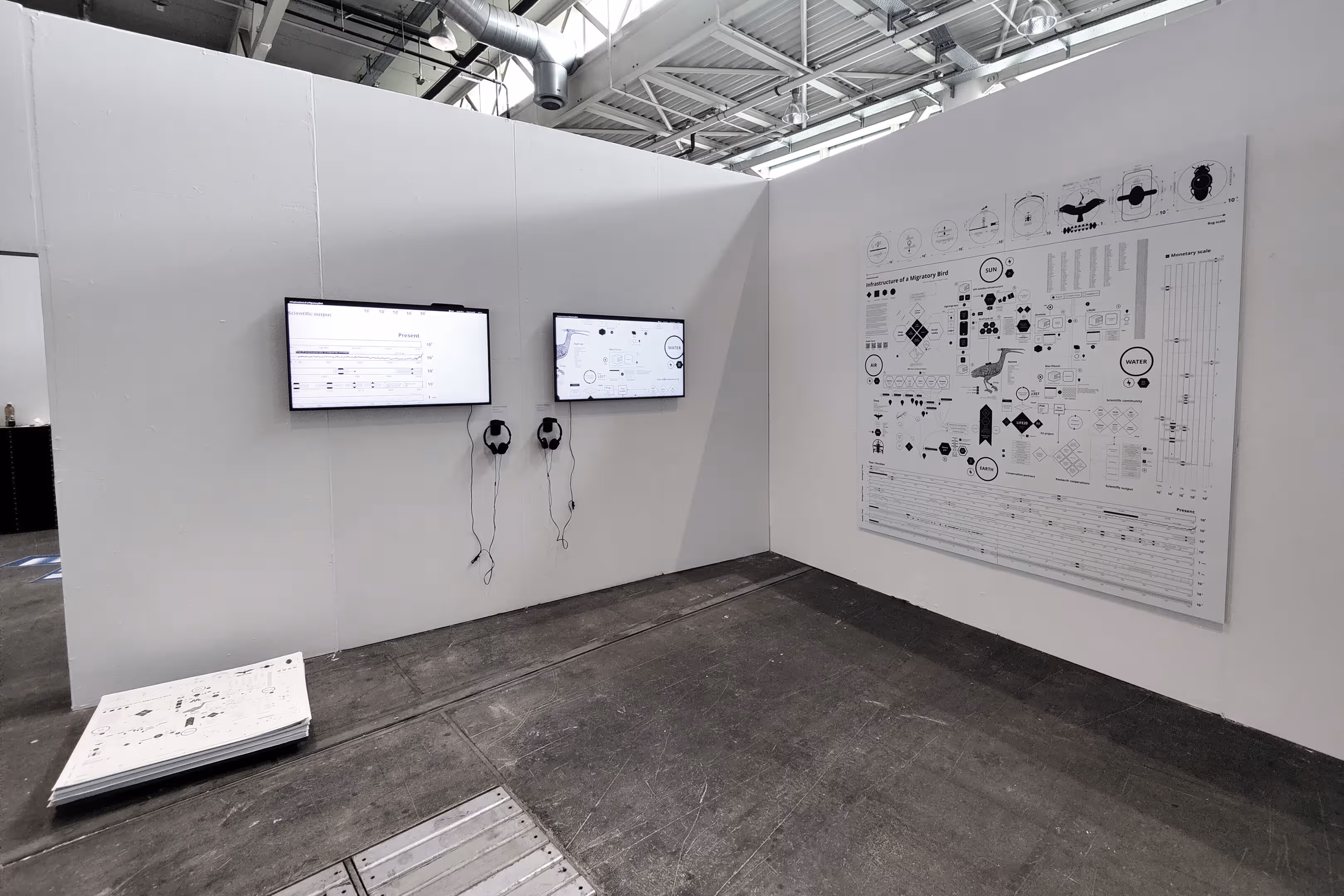
On the webpage one can explore different audio tours that allow for multiple readings of the infrastructure. We produced three distinct audio tours where participants can listen to a guided narrative, visually narrated by automatic zooms and pans that supplement the diagram by offering a performative reading of the visual knowledge. Accessible through our website, in one of the audio-tours called “My name is Enea” , we guide visitors through the infrastructure map while weaving together scientific data with anecdotal insights about the bird. This narrative approach combines factual information with a speculative perspective on the individual bird’s perspective. In another tour called “Flying through data”, the narrating voice takes us through the places where data on and about the bird is being captured and processed. Both of these examples contribute to a more inclusive, situated and context-aware approach to understanding of the bird’s ecosystem and interactions.
It consists of social, technological, scientific and ecological elements which are all related to each other. Albeit, the term infrastructure reminds more of water pipes, bridges, etc. we are more interested in the foregrounding of the backstage elements that are part of the rewilding project (Star 1999). It is divided into four quadrants; each containing elements of which all are in direct relationship to the bird and some that overlap into one or more quadrants. The bird itself is centred in the middle with the original illustration from Conrad Gessner’s Historia avium (1555) marking its first visual and scientific account.
Credits
This map represents the extent of the infrastructure in the early 2020s. It was realised by Vladan Joler, Gordan Savičić and Felix Stalder in the framework of the research project Latent Spaces: Performing Ambiguous Data, ZHdK between 2022-2023.
Download the map as PDF
Thanks to the Waldrapp team, especially Johannes Fritz and Helena Wehner for their collaboration.